
Report on storm and flooding damage in October 2016
October 2016 storm causes landslide and blocks Patches RoadReporting and photos from Andy Repetto, Tourism and Post Office Team and Barry Davies |
|
|
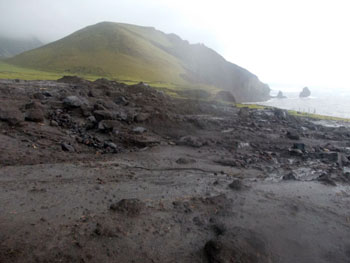
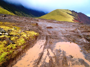
Heavy rain affected Tristan from Friday 7th October 2016. The community woke to heavy rain and strong winds on Saturday 8th keeping everyone indoors for the day. The heavy rain caused the main road to The Patches to be blocked with mud, gravel and boulders. Much of this material was washed out from debris collected at the bottom of the cliffs after a previous collapse and landslide. The road section known as Straight Bushes was blocked and stopped all access to the Potato Patches for the weekend. The stormy weather continued through the night and into Sunday 9th October That morning another landslide was discovered at Bugsby Hole causing more disruption for the community. Five photos below from the Post Office and Tourism Team show the scenes on Monday 10th October. |
|
 |
 |
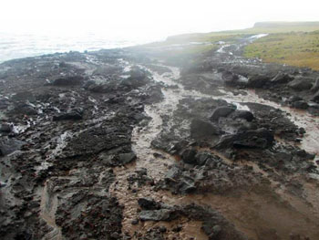
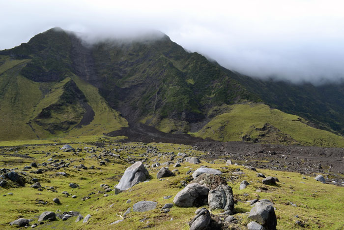
| Streams still flowing through debris covering Straight Bushes road as Bugsby Hole Gulch continued to flow. | Looking towards the mountain and showing the stony debris fan and landslip scar at the top of the cliffs along Bugsby Hole Gulch. |
 |
 |
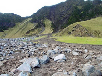
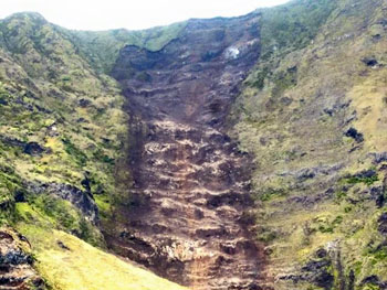
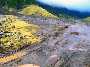
| Source of the landslide where part of the base edge has collapsed along the course of Bugsby Hole Gulch and created a huge scar on the cliffs exposing the alternate layers of volcanic ash and lava which make up the main sequence of the Tristan volcano. | View at ground level looking across the debris fan as Bugsby Hole Gulch continues to flow and showing the large boulders which initially fell in a landslide and which were then washed across the Settlement Plain by the flood. |
 |
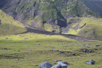
Final photo from 10th October of the new debris fan which has by now altered the old course of Bugsby Hole Gulch looking towards Hillpiece. |
|
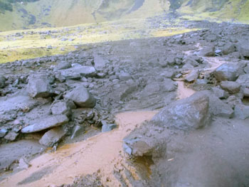
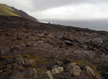
Heavy rain continued during the night of Tuesday 11th and the evidence of further flooding was again found Wednesday 12th. Large boulders and soil washed from the landslide at the base of the mountain at Bugsby Hole spread out further over the pasture and again covering Straight Bushes Road near Robert's Stone. Although it was a calm, dry start, the rain started once more later that day. Three photos below were taken by Andy Repetto on Wednesday 12th October |
|
 |
|
| View looking south towards the cliffs and showing the landslip scar above with a small waterfall cascading down the bare rock face, the newly formed alluvial fan below and the resulting outwash below covering the pasture and the main road. Note the huge number of older volcanic boulders littering the area, themselves deposited by similar mass movement years ago. These incidents are commonplace on the Tristan Settlement Plain, but this event of mass-movement at Bugsby Hole Gulch a significant as it is so disruptive to the crucial Settlement - Patches road and has destroyed several hectares of pasture. | |
 |
|
|
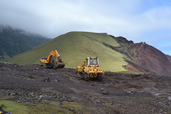
Above: Bulldozers in action clearing the road where Bugsby Hole Gulch has deposited its load, at Straight Bushes Road near Robert's Stone, with the slopes of Hillpiece forming a back drop. Right: Another view of the debris along the course and flanks of Bugsby Hole Gulch with the Knockfolly Ridge behind. |
 |
|
The rain continuing into Thursday 13th, so did the flooding. Unable to cross to get to the Potato Patches, people walked out to observe the damage and see where the cliff had considerably dropped away into the sea. The five photos below were taken by Barry Davies on Thursday 13th October. |
|
 |
 |
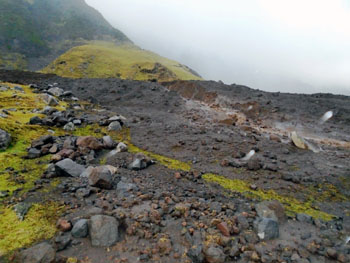
| PWD workers have started to re-instate the road at Bugsby Hole Gulch. | Close up of the sodden debris material which now dominates a large area of the Settlement Plain along Bugsby Hole Gulch and its flanks. |
 |
 |
| More photos of the debris and tracks showing where PWD vehicles have started making a roadway crossing Bugsby Hole Gulch. | 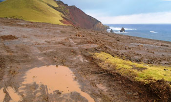 |
Barry Davies reported on 13th October:
|
|
| Friday 14th brought sunshine at last. The PWD department was able to tackle clearing the Straight Bushes road, while the community waited anxiously to be able to gain access to the Potato Patches. By the end of the working day a convoy of vehicles headed west to plant potatoes, unfortunately what was waiting for some islanders there was not good. Water had run through some patches washing out the potato seeds, while other patches had huge boulders in them which islanders were unable to move by hand. | |